Maps and Travel


Maps

Map of Spain with Valencia in dark green and Javea marked.

Map of Spain with Valencia in dark green and Javea marked. The area in the blue square is shown in more detail in the next map.
The costal area between Valencia and Alicante.

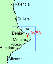
The costal area between Valencia and Alicante. The area in the blue square is shown in more detail in the next map.


The area around Javea, with the Natural Park in dark green

The area around Javea, with the Natural Park in dark green.


Travel: How to reach the apartment

You can reach Javea from either Alicante (El Altet) airport or Valencia (Manises) airport.

Both airports are about the same distance from Javea (approx 65 miles) and you can use the beautiful Mediterranean Highway (A7) which is a toll paying autoroute, or the free N332 that follows the coast and passes through all the coastal villages and towns on the way but is therefore a much slower route.

Both Alicante and Valencia airports are reached by commercial or charter airlines.

To make your stay more memorable, we would suggest that you rent a car in order to explore the area.

However, you can reach Alicante centre by the airport bus in about 20 minutes and then transfer to the Costa Blanca Express, or the regional train. Different bus companies connect coastal villages. The same applies from Valencia.

Exact details of how to reach the apartment (including detailed street maps of Javea) will be sent to you once you make a booking.


Contact Us >>